
There’s a quiet magic to early mornings in the wild. The fog still clings to the treetops, the ground is soft with dew, and somewhere in the distance, deer are already moving through the landscape you’re trying to understand. For decades, hunters and land managers relied on tracks, trail cameras, and intuition to figure out what was happening out there.
Now, that world is changing fast.
With modern aerial technology, the way we observe and manage deer populations has entered a completely new era. At the center of it all is the drone deer survey—a method that’s transforming wildlife tracking and habitat management with precision, speed, and a level of insight that was once impossible.
What Is a Drone Deer Survey?
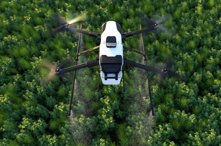
A drone deer survey uses unmanned aerial vehicles (UAVs), typically equipped with high-resolution cameras or thermal imaging systems, to locate, count, and analyze deer populations from above.
Instead of walking acres of land or relying solely on ground-based cameras, drones provide a bird’s-eye view of entire habitats in minutes.
These surveys can help identify:
-
Deer population density
-
Herd distribution and movement patterns
-
Bedding and feeding areas
-
Habitat usage across seasons
It’s like stepping outside your normal perspective and suddenly seeing the entire ecosystem at once.
Why Drone Deer Surveys Are Changing Everything
Faster, Wider, and More Accurate Observation
Traditional wildlife surveys take time—days or even weeks of fieldwork. Drones compress that into a matter of hours.
From open fields to dense woodland edges, drones can cover large areas quickly and consistently, reducing human error and missed observations.
This means landowners and hunters can make decisions based on real-time, reliable data instead of estimates.
Reduced Disturbance to Wildlife
One of the biggest advantages is minimal disruption. Instead of boots moving through bedding areas and pushing deer out of cover, drones operate from above, keeping human scent and noise away from sensitive zones.
That leads to more natural behavior observations and better data accuracy.
Access to Hard-to-Reach Areas
Steep terrain, thick brush, swampy lowlands—these areas are often difficult or dangerous to survey on foot. Drones eliminate that barrier entirely, making even remote sections of land visible and analyzable.
A Story From the Field
A land manager once shared a frustrating experience on a large mixed-forest property. Despite plenty of deer signs—tracks, rubs, and droppings—actual sightings were inconsistent. Hunters were spending entire weekends without understanding where the deer had gone.
Then came the introduction of drone surveys.
On the first flight, something surprising appeared. Instead of scattered movement, the deer were concentrated in a small, overlooked section of dense thermal cover near a water source. This area had been completely ignored in traditional scouting.
With that insight, the team adjusted their strategy. They limited pressure on that zone, created better access routes, and focused hunting efforts on nearby travel corridors.
The result? More predictable deer movement, improved harvest success, and a healthier herd dynamic overall.
Key Applications of Drone Deer Surveys
Population Estimation
One of the most important uses is estimating herd size. By scanning large areas during optimal conditions—often early morning or late evening when temperature contrast is strongest—drones can detect deer more effectively.
This helps:
-
Track population growth or decline
-
Set sustainable hunting quotas
-
Support conservation planning
Habitat Mapping
Drones don’t just find deer—they reveal how deer use the land.
You can identify:
-
Preferred bedding cover
-
Feeding zones (agricultural fields, food plots, natural browse areas)
-
Travel corridors between habitats
This creates a detailed behavioral map of the herd.
Seasonal Behavior Tracking
Deer behavior changes dramatically throughout the year. Drone surveys help capture those shifts:
-
Spring/Summer: feeding and fawning areas
-
Fall: rut movement patterns
-
Winter: survival-based clustering and food dependence
Understanding these cycles helps hunters and land managers adapt strategies effectively.
How Hunters Benefit the Most
Smarter Pre-Season Scouting
Instead of guessing where deer might be, drone surveys show exactly where they are currently active.
This gives hunters a huge advantage when planning stand locations or entry routes.
Better Shot Opportunity Planning
Knowing travel patterns reduces random encounters and increases the chances of encountering mature bucks in predictable locations.
Ethical Hunting Improvements
With better awareness of herd structure and movement, hunters can make more responsible decisions, reducing unnecessary pressure on young deer and maintaining balance in the ecosystem.
Actionable Tips for Effective Drone Deer Surveys
1. Fly During Optimal Conditions
Early mornings and late evenings are best due to temperature differences that improve visibility in thermal imaging.
2. Use Grid-Based Flight Patterns
Systematic coverage ensures no area is missed. Flying in overlapping grid lines improves detection accuracy.
3. Combine With Ground Truthing
Always verify drone findings with on-the-ground observation. Tracks, droppings, and trail cameras help confirm patterns.
4. Avoid Over-Pressuring the Area
Even though drones are less intrusive, frequent flights in the same area can still disturb wildlife behavior.
5. Follow Local Regulations
Drone usage laws vary widely. Always ensure compliance with wildlife protection and aviation rules in your region.
The Role of Technology in Modern Wildlife Management
Drone technology is just one part of a larger shift in how we understand wildlife. Combined with AI image recognition, GPS mapping, and thermal imaging, wildlife monitoring is becoming more precise than ever.
Soon, automated systems may even:
-
Identify species in real time
-
Track individual animals across seasons
-
Predict movement patterns based on environmental data
But even with all this advancement, one thing remains constant: the need for human understanding, interpretation, and respect for nature.
The Balance Between Technology and Tradition
For many hunters, there’s a concern that technology might take away from the traditional experience of being in the woods. But in reality, tools like drone surveys don’t replace that experience—they enhance it.
They give you a deeper understanding of the land, allowing you to connect with it more meaningfully. Instead of wandering blindly, you walk in with awareness, strategy, and respect.
Final Thoughts
The rise of drone technology has completely reshaped how we observe and manage deer populations. What once required days of effort and uncertainty can now be accomplished with clarity and precision from the sky.
By embracing the drone deer survey, hunters and land managers gain more than just data—they gain insight. Insight into movement, behavior, habitat use, and the delicate balance of the ecosystem.